
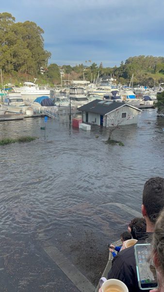
Tongan Tsunami Inundates Santa Cruz Harbor
Following last weekend’s tsunami we spoke with Port of Santa Cruz harbormaster Blake Anderson to see how the harbor fared now that they’ve had a few days to assess the damage. The good news is that the main harbor is in decent shape, the entrance is open, and life in the harbor is quickly returning to normal. The bad news is that there’s still quite a bit of damage that will take time to repair. The list ranges from minor inconveniences to some major expenditures. The North Harbor took the brunt of the surge. Flooding damaged 16 vehicles in the parking lot. Flooding in the upper harbor damaged restrooms and electrical equipment and washed soil out of embankments, harming roadbeds and shoreline protection. Three pilings broke. There’s damage to the UCSC rowing docks, and more. But it’s all much better than after the 2011 tsunami.
Joe Donatini of Johnson Hicks Marine Electronics caught this video of the surge invading the upper harbor.
Water drowned the transformers for the upper harbor, so some docks and liveaboards lost electrical power. Importantly, the dredge that keeps the harbor entrance open all season sustained damage, though apparently it should be back up and running early next week. Walking by or sailing into the harbor, visitors wouldn’t notice much amiss, but the current estimate to fix the damage from the tsunami is about $6.5 million.
Anderson said that after the extreme damage from the 2011 tsunami, about 20 boat owners decided to leave the harbor and head offshore before the arrival of this tsunami. Heading for deep water during a tsunami is often a wise move. It turned out fine for the boats that went out. But because of the damage to the dredge, it was difficult to return to the harbor. Some boats ended up having to stay out all night.
Anderson reported that it was likely fortunate that the tsunami came ashore at high tide. Because the tide was high, the parking lots acted more like a flood plain, allowing water to flow over the banks. At low tide the flooding would have been more constrained by the narrow walls of the harbor, potentially causing more damage to boats, docks and the embankment. Anderson estimates the harbor got about 4 to 5 feet of sea-level rise due to the tsunami. The parking lot ‘flood plain’ may have been good for the harbor, but not for the cars in the lot!
The tsunami warning stretched from Alaska to Chile, with only small pockets of damage along that enormous coastline. 99.99% of the coast experienced very minor effects from the tsunami. As in many natural disasters, local impacts can vary widely and be severe. In fact, we’re collecting some information from Tonga, where communications were largely cut off. It sounds as though The Boatyard in Vava’u, Tonga, was largely unscathed and may actually have suffered less damage than Santa Cruz, nearly 5,300 miles away. Unfortunately, that can’t be said for all the Tongan islands. Many are in dire circumstances. If you have more information on Tonga, let us know here.
When You Move Your Boat Cross-Country — in Pieces
In the January issue of Latitude 38, we shared the story of Steve Ingram, Allie Hawkins and Joyce Dostale, who, at the start of 2018, did not know one another, and by mid-2019 were partners in the Bay Area’s charter boat, Gas Light. In researching their story, we learned another interesting fun fact, one that didn’t fit into the pages of the magazine.
Did you know:
Gas Light co-owner Steve Ingram came to California with a dismantled boat that he had shipped across the country. He then rebuilt it and put it back in the water.
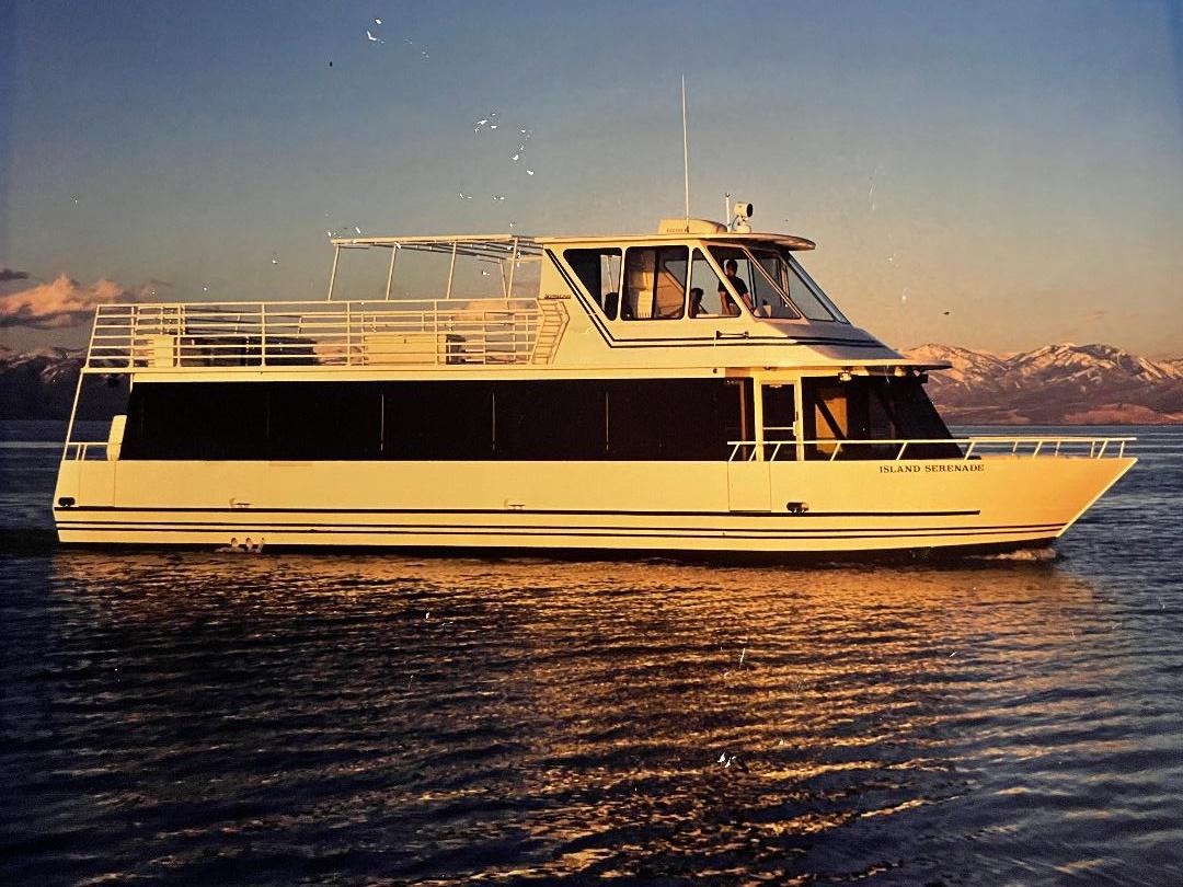
In 1995, while living in Utah, Steve and his parents commissioned the Great Salt Lake’s first (and for a long time, only) charter boat, Island Serenade. She was designed and built in Wisconsin and shipped in pieces to Utah, where she was reassembled and launched. Twelve years after they’d pioneered the Lake’s charter industry, the waters were drying up and had become too shallow for the boat.
“The lake was literally falling so fast that the bow of the boat was in the mud when we loaded passengers,” Steve said.
With no help with dredging coming from the state parks, Steve had little choice but to reconsider his chartering future. He took a trip to California with the hope of finding a new place from which to operate a charter business. “I literally drove around the Bay Area for a week, stopping in all local communities.” But no one was able, or perhaps willing, to give him space for a a commercial vessel.
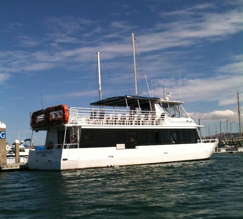
Until he reached Pittsburg. The town had just spent $12 million rebuilding its waterfront and was looking for a boat to showcase its new look. A deal was struck and Steve was ready to move in. The challenge would be to move the boat from Utah to the West Coast.
“I had already reassembled it 12 years prior, so it was up to me to move it to California.”
Two trucks and a special permit were needed to transport Island Serenade over the Sierra Nevada. Including the time spent waiting for the transport permit and later the Coast Guard COI, the impossible-sounding mission took a little less than six months to accomplish. “It ended up going some convoluted route through Susanville.”
But before Steve moved the boat, he had the sense to talk to the Coast Guard and find out what he would need to do to get the COI he would be seeking.
“I got hooked up with the greatest officer,” Steve said. “He was in charge of all inspections in the area. He said, ‘Pay for my flight, I’ll come up, I’ll look at the boat, and I’ll tell you what you have to do. Or I’ll discourage you completely. Or you may not want to do it at all.’ I said that’s not going to happen; I’ve got to do something with the boat.”
The officer worked with Steve for almost four months after the boat arrived in Pittsburg, the end result being a rebuilt vessel, complete with COI. By August 2008, Steve had completed his mission and was ready to begin his charter operation. “I had charters lined up, ready to go. And then, boom! — the economy crashed.” Fortunately the City of Pittsburg, which had loaned Steve the money to move the boat and set up his operation, was willing to work with him through the untimely financial disaster that caused repercussions throughout the US and much of the world.
“They were very nice, actually, extremely accommodating and understanding. By the following spring I was operating in the black already, because again, just like on the lake, I was the only show in town. For about 50 miles I was the only operation.”
Island Serenade remained in Pittsburg until 2012, when she was sold to Empress Events, which at the time was based in Sausalito. The boat was renamed Golden Gate Empress. The well-traveled ship was later sold, and once again disassembled and relocated, this time to Lake Tahoe, where she is reportedly working somewhere at the south end of the lake.
Steve laughed and said, “It’s almost put more land miles on it than sea miles!”
Read how Steve, Allie and Joyce came to buy a boat together in the January issue of Latitude 38: Three Strangers Buy a Boat.
Skippers Wanted: US Coast Guard-Licensed Captains for Charters and Private Lessons
Wanted: US Coast Guard-licensed captains for charters and private lessons. For power and sail. Hourly rate from $50 up. Weekend and weekday work available.
![]()
1160 Brickyard Cove Road, Suite 21, Richmond, California 94801 • (510) 236-2633 • [email protected]
- Current News
- Heading South
- Circumnavigators
- Safety
- West Coast Sailing
- General Sailing
- Racing
- Cruising
Need a Free Charting Resource? Try Chart Locker
While sailing tens of thousands of miles across the world’s oceans over more than a decade, Bruce Balan and Alene Rice have put their energy and resources to work on various causes and environmental endeavors, including the Pacific Manta Research Group and the Berkeley-based The Story of Stuff video. Now Bruce and Alene are on a new course with a free charting resource for cruising sailors.
For anyone cruising away from home, deciding which charts to use is crucial to safe navigation. Most boats now have chartplotters or tablets with charts provided by a single company. However, relying on only one source of charting information — and not using it properly — can lead to disaster. Just look at the loss of Vestas Wind in the 2014 Volvo Ocean Race.
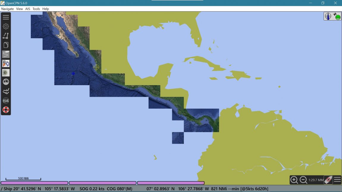
The good news is the prudent skipper can easily add an excellent charting tool for free. OpenCPN is an open-source charting program designed and built by boaters. It makes it easy to compare different charts, as it can display a variety of charting formats. You can also download all of the NOAA charts for the USA — as well as charts from several other countries — for free from within the program.
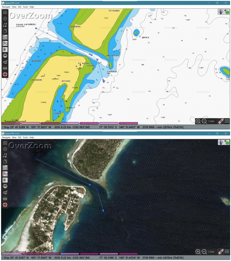
One source of charts for those sailing to Mexico or across the Pacific is The Chart Locker, a charting resource created by Bruce and Alene of the Cross 46 trimaran Migration. The Chart Locker offers free downloads of charts created from a variety of satellite image sources (Bing, Google and ArcGIS). All of these charts work in OpenCPN. The resolution of many of the charts is so good that you can see the individual coral heads in the atolls of the Tuamotus.
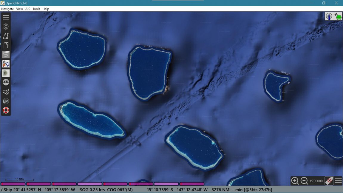
Currently, the Chart Locker covers the entire Pacific coast of Mexico and Central America, as well as all of French Polynesia, the Cook Islands, Tonga, Fiji, Vanuatu and many other Pacific islands. Check it out here.
Electronic charting is a great tool, but only if used correctly. Navigating a boat safely involves many factors — it’s much more complex than looking at a screen and steering a miniature representation of your boat around hazards. As the Chart Locker says, “It’s up to you to keep you, your crew and your boat safe. Always use multiple sources when navigating — including your eyes looking at the real world, not just a chartplotter.” ‘Nuff said.
- Maritime History
- Community Sailing
- Environmental News
- West Coast Sailing
- General Sailing
- Racing
- International Racing
- Current News
11th Hour Grant to Polynesian Voyagers
11th Hour Racing enters its 11th year of philanthropic work. The organization has announced five new grants, funded by The Schmidt Family Foundation, to support environmental projects in Connecticut, Maryland, Hawai’i and Rhode Island. 11th Hour Racing’s grants focus on pilot programs that model sustainability best practices, advance ocean stewardship, and create systemic change to restore ocean health.
The first-time grantees — Baltimore Compost Collective, Gather New Haven, Martin Luther King Jr. Community Center, Movement Education Outdoors and Polynesian Voyaging Society — provide experiential education, lead composting initiatives, and offer youth development opportunities.
Polynesian Voyaging Society
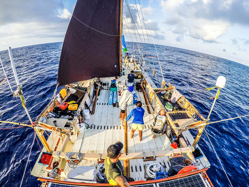
The Polynesian Voyaging Society will engage student navigators in storm training and the ancient science of non-instrument, wayfinding navigation while sailing through the ʻAlenuihāhā Channel between the islands of Maui and Hawai’i in preparation for crossing the Pacific Ocean from Alaska to Hawaii later this year. The project will galvanize action on climate change and inspire ocean protection. The organization is based in Honolulu.
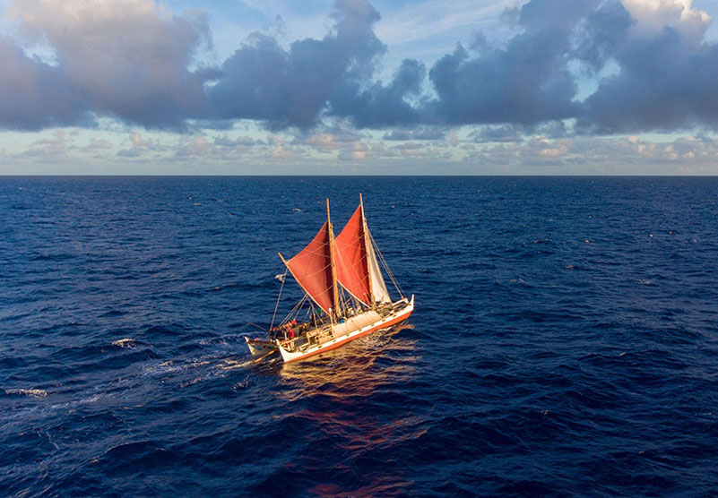
In 1975, the Polynesian Voyaging Society launched Hōkūle’a, a replica of a traditional Polynesian deep sea vessel. They built her to debunk the common theory that the Hawaiian archipelago was discovered by chance and to prove that Polynesians traversed the vast Pacific purposefully, using elements of nature such as the sun, clouds, currents, and bird migrations to set waypoints in ocean navigation.
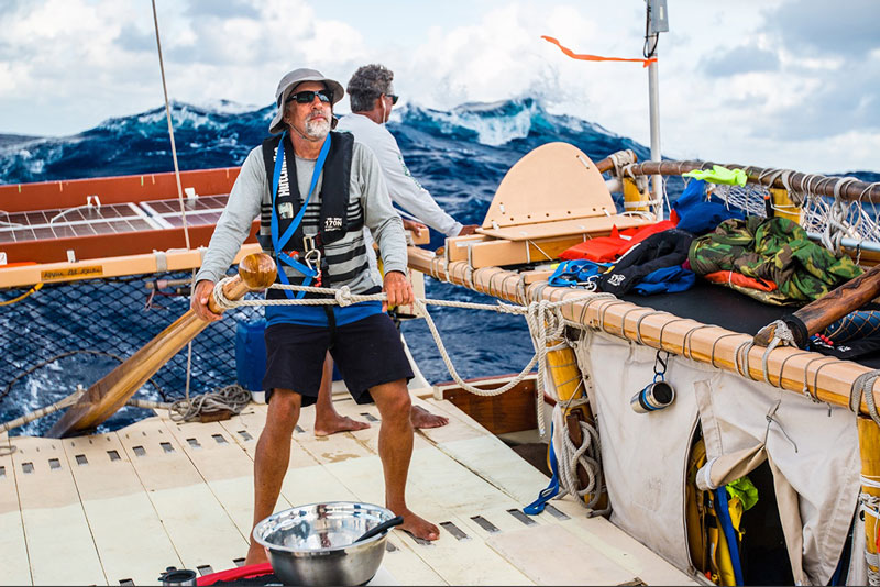
The goal is to preserve ancient Indigenous wisdom of navigation relying only on nature and native ingenuity to explore the open ocean. While visiting remote lands throughout the Pacific route, the project calls attention to climate change, inspiring action for ocean protection.
We’ve covered Hōkūle’a and the Polynesian Voyaging Society in previous posts. Hōkūle’a’s sistership, Hikianalia, visited San Francisco and Half Moon bays in 2018.
11th Hour Racing
“At 11th Hour Racing, we believe that building a community committed to ocean stewardship and environmental sustainability starts with meaningful experiences for young people, particularly for communities that historically have had less access to the ocean,” said Michelle Carnevale, vice president of programming at 11th Hour Racing. “Experiencing oceans, rivers and lakes firsthand and seeing all of the natural wonders our planet offers can be inspirational and lead to community-wide participation in sustainable initiatives. We are proud to support organizations that provide these experiences for young people along with pathways to future career opportunities.”
11th Hour Racing is accepting new grant applications through January 31, 2022. The organization awards grants globally and welcomes international organizations to apply. Learn more at www.11thhourracing.org.
Our readers may recognize the name of the team that has competed in world-class events, led by American skipper Charlie Enright. Bill Erkelens of Point Richmond is the chief operating officer. The 11th Hour Racing Team will sail in the Ocean Race, the circumnavigation formerly called the Volvo Ocean Race, and before that the Whitbread Race. Leg 1 will start on January 15, 2023, in Alicante, Spain. The course will round the Cape of Good Hope and Cape Horn. The several stops will include Newport, RI.
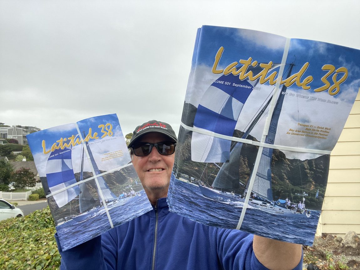
Latitude 38 Delivery Driver Wanted
We have a vacancy for a Latitude 38 delivery driver. Imagine being one of those wonderful people whom everyone is happy to see as you deliver bundles of joy to sailors throughout the Bay Area. This particular vacancy is for the Peninsula route, which starts at the St. Francis Yacht Club and ends at Sierra Point YC in Brisbane.
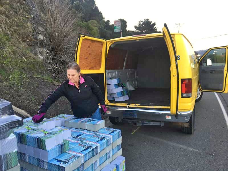
It’s the perfect sailor’s job: 29 days off every month! On the first of each month you will deliver Latitude 38 magazines to our Bay Area distributors. That’s it! Take the rest of the month off and go sailing.
Our drivers are also ambassadors for the West Coast’s premier sailing and marine magazine. Applicants should feel comfortable engaging with our wonderful distribution team and maintaining relationships with sailing and marine businesses in the Bay Area. An ideal candidate will keep track of the magazines delivered to each location and look out for new distribution locations.
To apply, send your résumé and cover letter with sailing experience by email to [email protected] with “Latitude Driver” in the subject line. Please, no phone calls!