NOAA Launches Pacific Basin Gridded Forecasts
In an announcement issued this week, NOAA advised that its Pacific Basin gridded forecasts are good to go. That’s just in time for the start of the 27th Baja Ha-Ha and the ‘heading south’ cruising season.
NOAA’s offshore and high seas gridded forecasts for the Pacific Basin transitioned from experimental to operational on October 28 — yesterday!
The forecasts originate from the Tropical Analysis and Forecast Branch (TAFB) of the National Hurricane Center (NHC), the Weather Forecast Office (WFO) in Honolulu, Hawaii, and the Ocean Prediction Center (OPC).
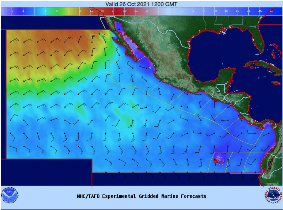
There are five elements making the transition: 10-meter (33-ft) wind speed; 10-meter wind direction; 10-meter wind gusts; significant wave heights (or “seas”); and marine hazards. Transitioning these forecasts to operational status is another milestone for the NWS National Digital Forecast Database (NDFD) and follows a similar move in December 2017 with the Atlantic offshore grids. Users do not need to take any action when the experimental forecasts transition to operational status.
An example of the wind and wave grids from NHC/TAFB is shown below for a forecast valid at 1200 GMT Tuesday, October 26, 2021:

Graphics depicting the gridded winds, seas, and hazards are available through NHC/TAFB’s Marine Graphical Composite Forecast Map at: https://www.nhc.noaa.gov/marine/forecast/enhanced_epacfull.php .
The gridded forecast graphics can be found at https://digital.weather.gov/ https://digital.mdl.nws.noaa.gov, https://ocean.weather.gov, and https://weather.gov/hfo.

To the scientific mind “The wind barbs represent wind speed and direction. ” must make perfect sense but I had to look it up once more. In the chart above the “bulb” opposite the barbs is downwind. If there are no barbs then the part extending from the “bulb” is where the wind would be coming from if there were any but since there is none just the “bulb” is shown. There does not seem to be any indication of why the barbs are drawn to starboard as they are (or is that port?). I think it would be interesting to see the barbs change side depending on the relative barometric pressure. If I picture that correctly it would show the wind speed, direction and trending shift almost like a isobar overlay.
“A clarification concerning the barbules attached to the wind arrows: in addition to indicating the force of the wind, they should indicate the relative position of the low pressure zones, and therefore be positioned on the left in the Northern hemisphere and on the right in the Southern hemisphere.”
See: https://content.meteoblue.com/en/specifications/weather-variables/wind