

El Niño Heating Up With Hurricanes Polo and Odalys
As predicted, the El Niño-influenced 2026 hurricane season is producing more hurricanes in the Pacific and fewer (none so far!) in the Atlantic. Currently, Hurricane Polo is churning up the ocean off the west coast of Mexico — it quickly turned into a Category 5 storm with wind speeds reaching up to 180 mph.
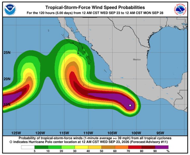
It has been a busy year in the Pacific, with most of the 16 named storms in the Pacific moving west toward Hawaii rather than impacting the Mexican mainland. That hasn’t been good for Hawaii. Although they haven’t had any direct hits, the islands have had significant rainfall, flooding and wind damage.
Of the 16 named storms in the Eastern Pacific, five have been hurricanes, and three of those have been major hurricanes. Hurricane Polo is said to be the second-strongest hurricane on record in the Eastern Pacific. Meanwhile, the Atlantic has been mostly quiet and calm, with only six named storms and no hurricanes.
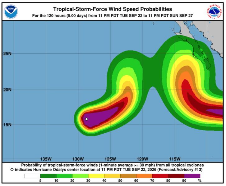
Following Hurricane Polo up the Eastern Pacific is Hurricane Odalys, which is farther, offshore but still heading east.
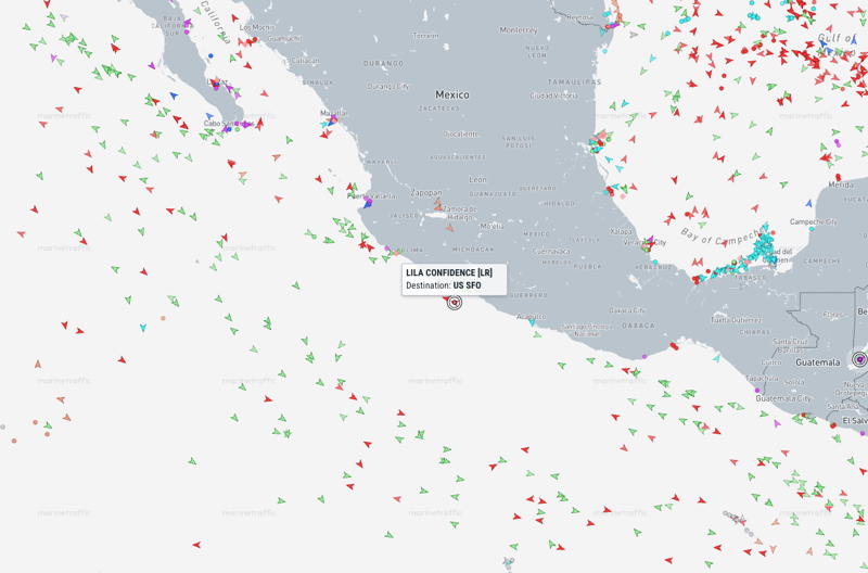
You can see lots of marine traffic in the Marine Traffic site’s image above. They are giving the area around Hurricane Polo space, but given the scale of the storm, it still looks uncomfortably close to us. We assume the captain of the Lila Confidence has confidence in their ship and the forecast path of the storm.
There are about six weeks left in the “official” hurricane season, and despite the increased activity, damage to the shoreline has been limited (though wind, rain, waves and storm surge can still wreak havoc).
We hope the number of hurricanes slows down and that those that do form continue the trend of staying offshore.