
Two Tropical Storms Threaten Mexico
As of 8 a.m. this morning, Hurricane Jova, a powerful Category 3 hurricane, and Hurricane Irwin, now down to tropical storm force, threaten the coast of mainland Mexico.
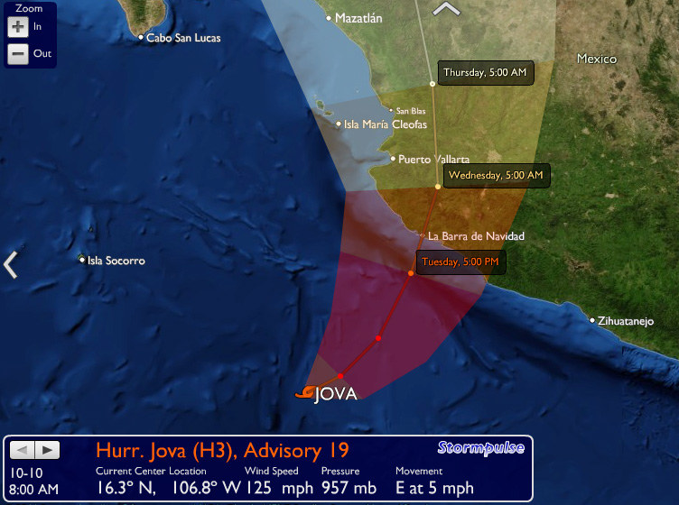
The most recent forecast predicts that Jova will make landfall a few miles north of Barra de Navidad with 125-knot winds. This would put Barra and Manzanillo in the ‘dangerous semi-circle’ where hurricane force winds are the strongest. This forecast landfall would be about 85 miles south of Banderas Bay and Puerto Vallarta, which are currently forecast to be hit with winds of 40 to 58 mph. There is hope that the tall jungle mountains might help mute the force of the storm. On the other hand, the margin of error for the place of landfall is still about 100 miles, which means it’s possible Jova could make a direct hit on Banderas Bay, which has reportedly never taken a direct hit before. The powerful storm is expected to hit at about 11 p.m. on Tuesday, so keep your fingers crossed for those in its path.
The news for Irwin is better. It’s currently blowing at less than 50 mph and is forecast to nearly parallel the coast to the southeast — talk about 180 degrees off the normal hurricane path! — in the general direction of Zihua and Acapulco.