Hurricane Sam Makes Slow Progress in Atlantic
The 2021 hurricane season continues as the newly named Hurricane Sam takes a slow path toward the Caribbean. After being monitored by the National Hurricane Center (NHC) as a tropical storm, Sam was upgraded this morning, making it the 18th hurricane this season. The NHC described the hurricane’s current activity as “taking a momentary pause from intensification.” And while Sam doesn’t appear to be in any great hurry at the moment, its projected path could see the weather system crossing the Leeward Islands next week.
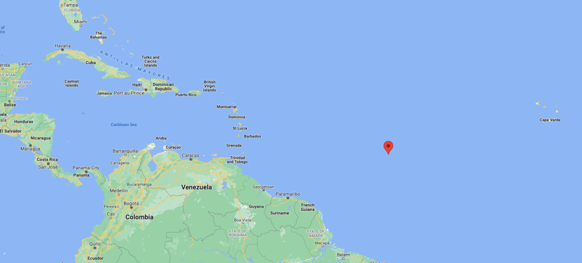
According to the latest NHC advisory, at 8:00 a.m. today Sam was situated near 11.8N, 43.7W.
The report continues. “Sam is moving just north of due west near 14 mph (22 km/h) and this motion is expected to continue through tonight. A decrease in forward speed and a motion toward the west-northwest are expected over the weekend. Maximum sustained winds remain near 75 mph (120 km/h) with higher gusts. Rapid intensification is forecast to resume over the next several days and Sam is likely to become a major hurricane on Saturday. Hurricane-force winds extend outward up to 15 miles (30 km) from the center and tropical-storm-force winds extend outward up to 60 miles.”
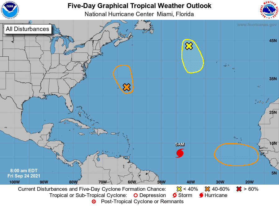
Right now we don’t know what is in store for the Leeward Islands, or for any other of the Eastern Seaboard localities, but from the indicators on the current forecast map, there is potential for a couple of tense weeks for our friends in Hurricane Alley.
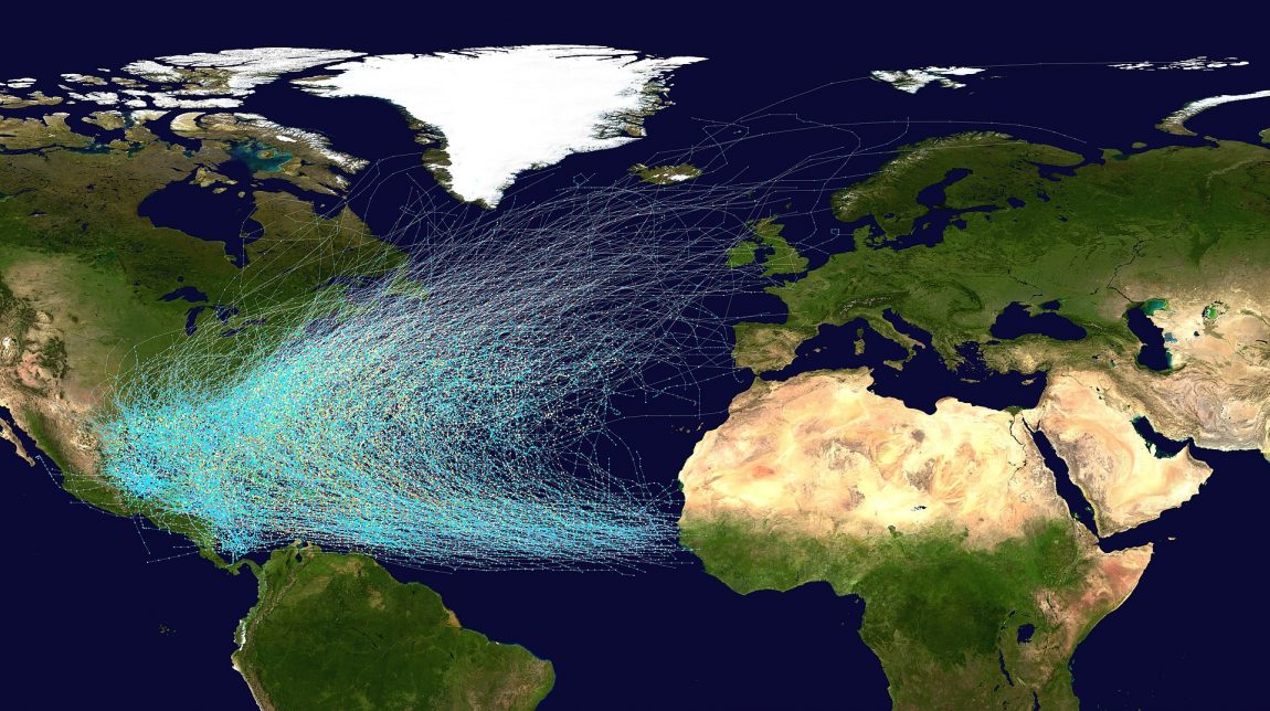
In the meantime — not to minimize the suffering and tragedy that can result from hurricanes — we did find this very cool image that illustrates the hurricane tracks in the Atlantic, 1851 to 2019.