
Eight Bells for Chris Corlett
©2012 Latitude 38 Media, LLC
Friends report that Chris Corlett, a lifelong fixture in San Francisco Bay sailing, passed of natural causes in his sleep last week. Prior to the founding of Latitude — we’re talking more than 35 years ago — Corlett was one of the top helmsman on the West Coast. In more recent decades, he sold boats for a number of different yacht dealerships.
Decades ago Corlett and Tom Blackaller — who, prior to Paul Cayard, was the most famous sailor to come out of San Francisco — were involved in perhaps the most famous mano a mano sailing duel in Northern California. You have to understand that 35 years ago Mariner’s Square in Alameda was in many respects the center of sailing in Northern California, and it’s where young bucks such as the vociferous Corlett challenged only slightly older established bucks such as Blackaller — and often in front of half the sailing industry in Northern California. It happened so long ago that we’re a little fuzzy on the details, but either Blackaller or Corlett had bested John Beery in a match race in Lasers from Mariner’s Square to the mouth of the Estuary and back. This was a big deal in itself, because not only was Beery no shrinking violet, he was also the landlord for Blackaller’s North Sails and the yacht dealership Corlett worked for. After Beery was bested, Corlett and Blackaller got into a public spat over who was the better sailor. Another race to the mouth of the Estuary and back was proposed, but this time in Santana 35s. It was a bad choice of boats for Blackaller, as Corlett sold the 35s and had raced them extensively, so he clobbered the then-king of San Francisco sailing in front of much of the sailing industry. There was more than a little gloating.
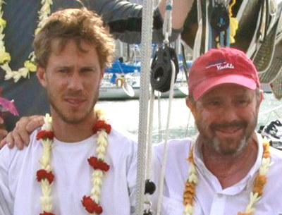
Corlett’s most recent racing was in this summer’s Pacific Cup with his son Jesse aboard David Britt’s Beneteau First 10R Split Water. "He told me it was his most gratifying sailing experience," longtime friend Allison Lehman told us. "He was so proud of his son; he called him a ‘natural’."
A celebration of Corlett’s life will be held at Encinal YC in Alameda this Friday, November 30, at 1 p.m. Friends and family ask that you be prepared to share your favorite photos and stories.
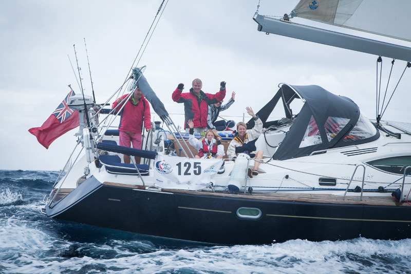
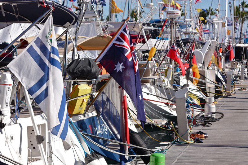
27th ARC Rally Sails From the Canaries
Now celebrating its 27th year, the Atlantic Rally for Cruisers (ARC) got underway from the Canary Islands yesterday with a fleet of 192 boats from at least 29 countries.
Although skies were clear just prior to the first start 10:45 a.m., skies soon turned cloudy, bringing 25-knot winds and rain squalls. Wet, but thankfully not cold, as Gran Canaria, where the start was staged, like at latitude 28N, just 135 miles off the southern tip of Morocco.
Although you may not be lucky enough to be doing the rally this year, you can follow the action via the online fleet viewer, read news updates on the ARC website and/or read the blogs of specific boats. As you’ll see, after only a day at sea a number of boats have substantially pulled away from the bulk of the fleet which is clustered together as it angles southwest, soon due to pass abeam of the Cape Verde Islands. The only reported mishap so far is a Delphia 33 named Julia lost its steering and is being towed to Tenerife.
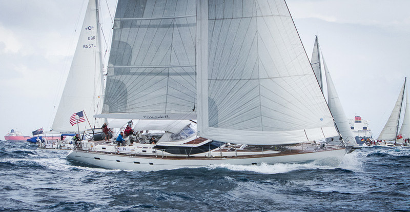
As in year’s past, the rally will end at Rodney Bay on the Eastern Caribbean island of St. Lucia, a rhumbline distance of roughly 2,700 miles. Looking at the current forecasts, the fastest boats are expected to make landfall in about 12 days — some, perhaps, even threatening the ARC record of 11 days, 5 hours and 32 minutes set in 2006 by the Italian boat Capricorno. The majority of the fleet should take 18-21 days, in time for the awards ceremony on 21 December.
The majority of the ARC fleet views the crossing as a "fun rally," and as such, they are allowed to motor (with elapsed time penalties). There is a serious racing division, however, with is, of course, sail only, which uses IRC ratings. Look for further updates here, and in the pages of Latitude 38.
World Sailing Speed Record Smashed
Not generally known as a sailing mecca, Namibia seems to be the place to break world sailing speed records. Aussie Paul Larsen chose the country’s Walvis Bay on the Skeleton Coast for its flat water and strong winds to attempt to break the 500-meter outright sailings peed record — held by kiteboarders for the last three years — with his custom carbon fiber, wing-sail hydrofoiler Vestas Sailrocket 2. He accomplished his dream on November 16 with a speed of 59.39 knots (55.32 knots over one nautical mile), then broke it again on November 24 with a speed of 65.45 knots!
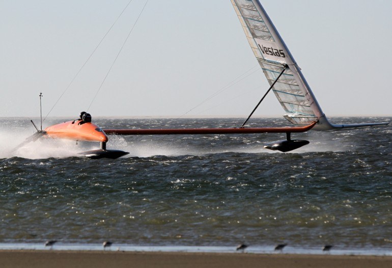
"We hit it hard and the acceleration was rapid," Larsen wrote on his blog. "We went straight into the 60s. The pod was instantly high and I sheeted in as hard as I could to try and get it down. I was now adding a pre-fix to ‘fast’. It was now ‘This is fucking fast’. That word is there for moments like this. I believe it ceases to be swearing." No kidding!
Even more speed records were broken in Lüderitz, Namibia, at the Lüderitz Speed Challenge, a contest for windsurfers on a flat, straight channel dug for the event. More than a dozen speed records were broken at the event, including Antoine Albeau’s (FRA) setting of a new world windsurfing speed record of 51.68 knots.
The Mysterious Disappearing Island
With modern advances in science and technology, it seems that new things are always being discovered, be it a miracle drug, a cure for a disease or a previously unknown species. So it’s not every day when something gets “undiscovered,” but that’s exactly what happened earlier this month when a research vessel in the South Pacific went to look for Sandy Island (also known as Sable Island), shown to be located halfway between Australia and New Caledonia on Google Maps and on scientific — but not navigational — charts.
"We saw this mysterious island on all the scientific maps and weather maps but not on this one navigational chart that was on our ship," said Sabin Zahirovic, part of the research team aboard RV Southern Surveyor. "So we decided to go see if it was actually there."
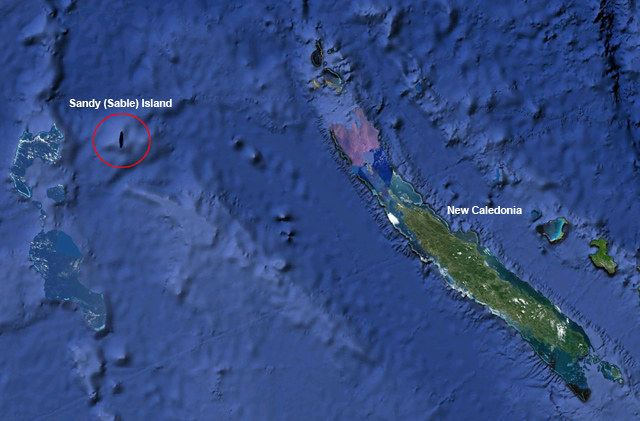
The research vessel, whose mission was to study tectonic evolution of the Eastern Coral Sea arrived at the island’s known position at night. The reserachers watched their depth finders and navigation equipment closely, but to their astonishment they found nothing but open sea. "The captain was actually quite nervous because the island was showing up on all the maps. Luckily for us the sea floor turned out to be very deep there”, added Zahirovic.
While the “un”-discovery was not part of the ship’s research mission, it’s very significant nonetheless. "All the scientific cartography relies on these maps, and numerical simulations of waves and currents depend on (the) size of these land forms," said Zahirovic. "It just goes to show the oceans are so underexposed. It’s actually really shocking that we haven’t not found more islands."
According to Jethro Lennox, publisher of The Times Atlas of the World (in which the phantom island had been featured at one time), "Back in the 19th century, cartographers would gather their information from various sources like explorers or even sailors, so you could never have a perfect map." Interestingly, the nautical navigation charts show nothing but deep water at the island’s supposed location.
This just goes to prove that while Google Maps might be great for quick planning purposes, you don’t want to use it for navigation!