
What’s the Sketchiest Harbor You’ve Ever Sailed Into?
On my last day in New Zealand, a trip marked by the start of the pandemic and cancelled flights, we took a long drive south along the east coast of the North Island. After weeks of lingering near a marina and an industrial hub, a drive — and the proverbial stretching of the legs — was welcome respite from the quarantine routine of long walks to the grocery store. As I’ve mused many time before, all things New Zealand could easily be all things California. The road wound through rolling hills and past long beaches with small, weak waves. The end of the road, however had some of that unique Kiwi character. Whakatane (pronounced fah-kah-TAH-nə), a town of 37,000, is wedged between a steep hill and a long river. It was another New Zealand town carved around the country’s unique geography.
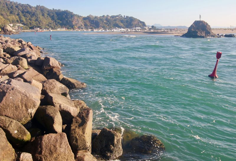
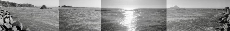
And where river met sea in Whakatane sat one of the narrowest and awe-inspiringly sketchy harbor entrances I’ve ever seen.
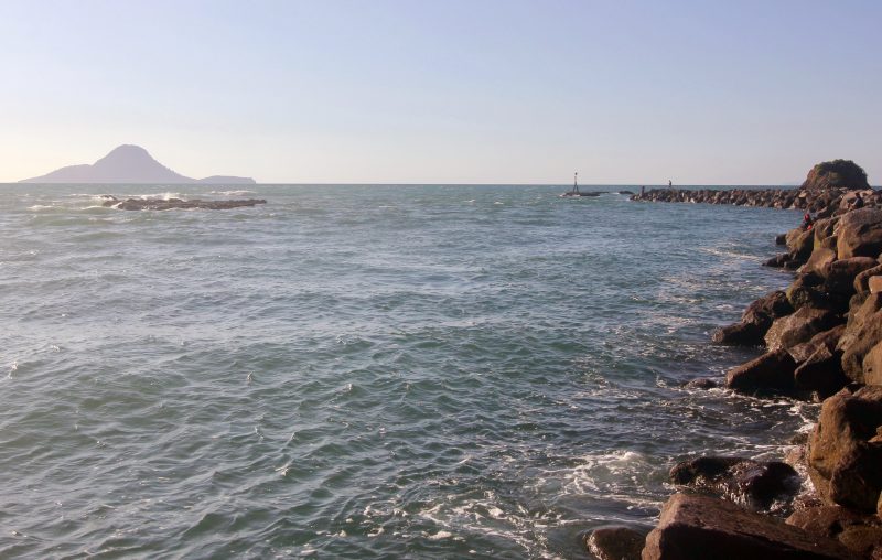
Slabs of rock dotted the harbor entrance, creating a tiny mouth for navigation. The ebb made the entire river stand up, causing the channel markers to ‘heel’ under the heft of the water. As I imagined sailing in on a 35-ish-ft boat, the channel seemed maybe a boatlength and a half wide in most places.
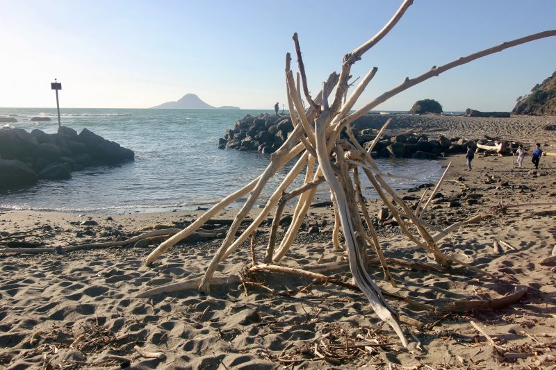
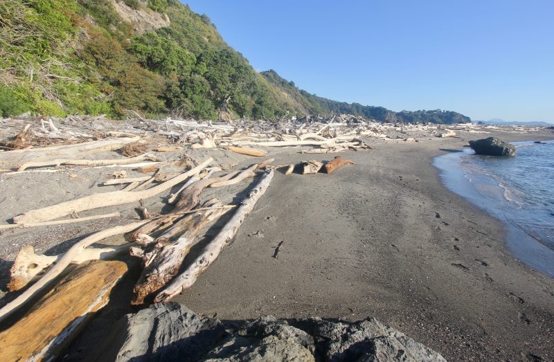
The entire beach at the bitter end of Whakatane was littered with piles of driftwood. Everything about the locale suggested a regular onslaught by the sea. We caught it on a day with no swell and maybe eight knots of breeze, but still, for this relatively inexperienced coastal cruiser, everything about the place felt intimidating. The currents at latitude 37 south rivaled our famous Bay Area tides, creating standing wavelets and a general agitation on the water.
Anyway, Whakatane got us thinking: What’s the sketchiest harbor you’ve ever sailed into? We’ve heard many a Pacific Northwest-based Baja Ha-Ha veteran tell us that the trip down from latitude 40+ put them in the way of several scary harbor entrances — the Columbia River ranking high on the list. Humboldt and Fort Bragg can get fairly sporty, too. But we’re thinking global here, Latitude Nation. We hope to hear harbor stories from the Seven Seas. Please comment below, or email us here.
Please be sure to include your boat name, make and port of call, or just tell us where you’re from.
That would be Olongopo City on Subic Bay while on a WESTPAC in 1986.
But that’s probably not the kind of sketchy you meant. 🙂
Dingwall, NS on Cape Breton Island, just south of Cape North. Fortuntely I was entering behind a local fishing boat, so I witnessed the right angle turns in an unmarked section of inlet. Fired up the forward scanning sonar and was able to see the unmarked ledges. Perhaps there were charts that might have shown them, none of mine had that detail on a relatively small inlet. We anchored, rowed ashore and started walking, carrying a jerry can for diesel. A very kind family picked us up in their pickup, took us to the fuel station and back. “Lioness” 1962 Hinckley Bermuda 40 Csustom Yawl. Currently Homeported at OYC, Alameda
Xcalak, MX. Coming in with a swell running was the most alarmed I’ve ever been in a sailboat.
Hello,
Loved your descriptions of Whakatane but need to correct you on one thing. The active volcano is called White Island not White Mountain. Anyhow glad you enjoyed your stay here.
Thanks, Judith!
One of two places in Mexico, specifically San Evaristo as tropical storm Iselle passed by. But for ultimate “don’t make a mistake or you’ll be in tomorrow’s news” experience, inbound over the Columbia River Bar in September 2008 was the tops. 14-15 foot breaking waves every 5-10 seconds, preventing us from going back out and waiting. Couple that with light fog to make sighting the south jetty probematic, and it all resulted in a 30 minute transit that scared those of us who’d done the crossing before, and left one newbie absolutely catatonic.
Things finally settled down around buoy 10, and when we got into the West Basin in Astoria, my wife was waiting on the dock for us and immediately knew we’d been in a tense situation. It was only hours later that I really understood how bad it could have all ended up. At the time, I was too busy getting us into safer waters.
Oh, at the cold beer at the dock in Astoria when we arrived was better than ever. We didn’t care that it was only 0830…
Chivirico, Santiago de Cuba on a pitch dark night. Upon approach, we notice Addison Chan’s shiny new Waterway Guide to Cuba was word for word the same as Nigel Calder’s 20+ year old guide to Cuba. Apparently, the new book has new info for the big marinas one the North Coast, but cut and pasted (and gave credit to) Calder. In any case, both discouraged night entry.
We managed, with our buddy boat and sister ship ‘El Gato’. The next morning, in the light of day, we saw the sad sight of a monohull sitting on the reef, and watched as her mast failed from the pounding.
We recommend daylight entry here!
Ventura Harbor a few years back. The shoaling had gotten really bad, and the dredging was way behind schedule. Sailed up from Channel Islands Harbor and waves were literally breaking inside the channel markers. Was about to turn back but saw my opening. Headed in and made it. The next day the harbor master said if we wanted to get out of there, now was the time as they were going to close it. Bolted out of there and they closed the harbor for a few weeks right after.
Santa Cruz can be very sketchy if there’s a swell running, along with the sand bar inside to deal with as well. La Push Wa. is also a pretty sketchy place.
Oceanside, ebb with surf. It looked a wee bit marginal but doable, despite the giant dredger parked in the entrance. We waited for a quiet interval but miscalculated and wildly surfed in on a breaking wave while squeezed tightly between the breakwater and the dredger, whose crew left the warmth of the bridge to watch.
Entering Manihi in the Tuamotus. Arrived at high slack but waited for the time given us by a local islander. Current quickly increased to about 4 knots, got past the pearl pens and were in! Next time if it looks slack, it is slack!
In 2013 we entered Marina Puerto Salina, just north of Ensenada. The marina advertised a 14 foot minimum depth in the entrance channel, but (although we did not know it) their dredge had been broken for months. We entered at high tide and rode into the entrance channel on the back of a strong westerly swell, which propelled us over the bar that blocked the channel with our keel dragging. Our boat draws 4 1/2 feet. When we entered the marina another boater yelled: “how the hell did you get in here, the channel is blocked.” We quickly learned that dozens of sailboats were trapped in the marina due to shoaling at the entrance. It looked like we had just entered the Hotel California of marinas: you could check in but you couldn’t get out. Fortunately for us, a very high tide was expected two days later. By carefully surveying the entrance with a handheld depth gauge I was able to find a zigzag path that allowed us to escape. Many of the other boaters were not so lucky; they were trapped there for months.