
Racers-Turned-Researchers Return
©Latitude 38 Media, LLC
The first of two dozen Transpac race boats that had been recruited to do ocean research returned to the Bay last week, carrying with them samples of degrading plastic debris collected in the massive Pacific Garbage Patch. The effort, called The Mega Expedition, will give researchers a more comprehensive ‘map’ of Eastern Pacific pollution than has ever before been created. The Expedition’s parent project, The Ocean Cleanup, aims to rid the Patch of at least half of its garbage within 10 years of deploying a purpose-built collection device in 2020.
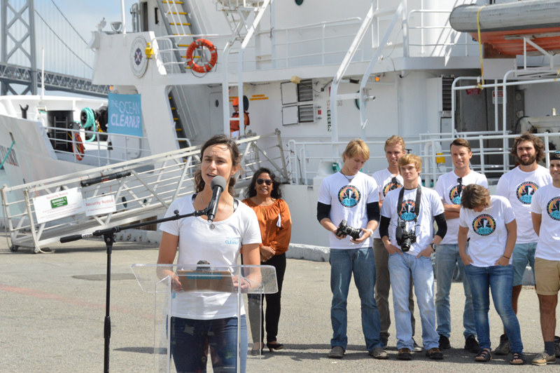
Mainstream interest in the project, both locally and internationally, was evident at a press conference Sunday, attended by all Bay Area network television affiliates, radio and print reporters, and foreign journalists. The focal point was the arrival of the project’s flagship, the 171-ft research vessel Ocean Starr, as well as the Rogers 46 Varuna and the TP52 Patches. As reported earlier, the Cleanup’s concept was envisioned by then-teenager Boyan Slat of The Netherlands (now 21), who has earned accolades from scientific organizations as well as the UN. The project is now supported by many international scientists and volunteers, and has secured substantial funding from Marc Benioff, CEO of San Francisco-based Salesforce, the Bill and Melinda Gates Foundation, and the Dutch government, in addition to more than $2 million through crowd-sourced funding.
©Latitude 38 Media, LLC
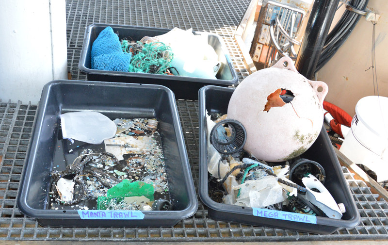
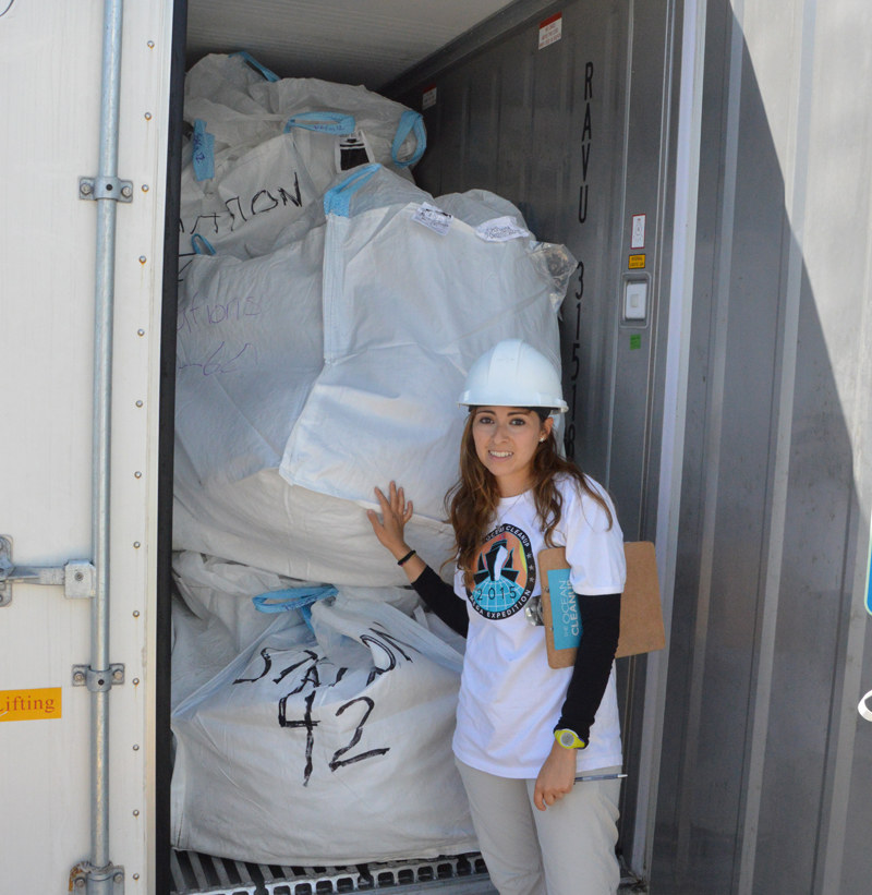
The Mega Expedition involved widespread deployment of collection devices called manta trawls (from the Transpac race boats) and mega trawls (from the Ocean Starr), which were towed for predetermined lengths of time along specific latitudes. The collected samples are now being shipped to The Netherlands for analysis, which will reveal the best location to place the collection device that Slat invented. It is comprised of a sixty-mile-long system of "booms" that will funnel trash and particulate matter to the apex of the “V”, where it will be stored in a silo for eventual removal by barge. The first prototype of the trash-collecting device will be deployed off Japan next year.
"The vast majority of the plastic in the Garbage Patch is currently locked up in large pieces of debris," explains Slat, "but UV light is breaking it down into much more dangerous microplastics, vastly increasing the amount of microplastics over the next few decades if we don’t clean it up. It really is a ticking time bomb."
©Latitude 38 Media, LLC
We encourage you to check out the project’s website, and look for more on this effort, including perspectives from returning Transpac "research" vessels, in the October issue of Latitude 38.
Getting Ready for the Ta-Ta and Ha-Ha
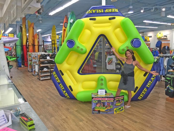
"What we really need for the SoCal Ta-Ta and the Baja Ha-Ha is our own island," the Grand PooBob/Grand Poobah was thinking to himself the other day. Fortunately, he was walking through the West Marine Super Store in San Diego at the time, and nearly ran into something called the Airhead Reef Island. While not noted on any NOAA charts, the PooBob/Poobah figured that anchored off Prisoners at Santa Cruz Island, and Bahia Tortugas and Bahia Santa Maria on the coast of Baja, the Airhead Reef Island is all the island the Ta-Ta and Ha-Ha would need. So he bought it.
©2015Latitude 38 Media, LLC
In fact, he can visualize an October or November Latitude 38 cover featuring a group of Ta-Ta’ers or Ha-Ha’ers in the foreground on the island, and either many boats of the fleet or dramatic scenery in the background. The Latitude drone will make the aerial photo possible. If you want to be part of the fun — and maybe the cover photo — you will have to try to get a crew position on the Ta-Ta, which starts from sunny Santa Barbara on September 13, because all 50 boat slots sold out long ago. There is still room for more boats in the Ha-Ha, however. The deadline for signing up for the Ha-Ha is September 15, while the start itself is October 26. Frugal sailors should note that you can easily recoup the $375 entry fee in discounts on berthing and other things before and after the Ha-Ha. To sign up for the Ha-Ha, visit www.baja-haha.com.
©Latitude 38 Media, LLC
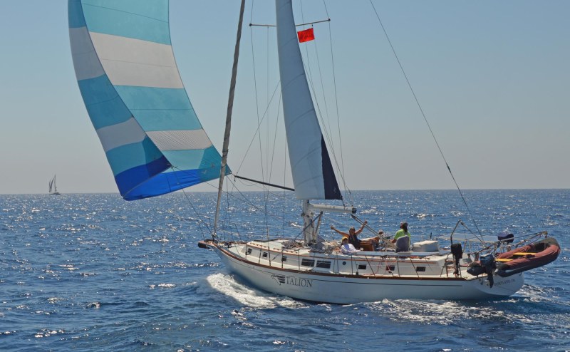
Having just motored up from Cabo ‘Summer Sauna’ Lucas, we’ve really been enjoying the nearly ideal Southern California weather, and are keeping our fingers crossed that the Ta-Ta will have weather as terrific as it did last year. That said, what we’re really looking forward to is the 750-mile Ha-Ha sail back down to Cabo starting on October 26.
What’s sailing in the Ha-Ha like? The 360-mile first leg completely removes you from civilization, leaving you in undiluted nature. A bunch of entries in this year’s Ha-Ha asked if they could please have a full moon sometime near the start to ease everyone into night watches. "Why not?" we responded, and have arranged for a full moon on October 27, the second night of the first leg.
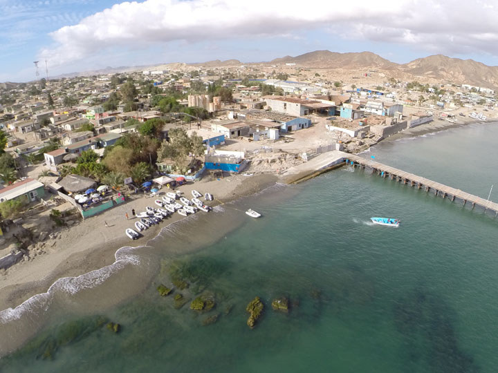
Arriving in Turtle Bay, with its dirt streets and incongruously beautiful baseball field, it’s a bit of a shock for some first-timers. But thanks to all the other Ha-Ha folks, and the friendly folks of Turtle Bay, the shock quickly wears off. This is especially true after the Cruisers-versus-Mexicans baseball game, which is like baseball on speed. You know how when you watch a regular baseball game it’s like watching paint dry? Not at the Cruisers-versus-Mexicans baseball game, where it’s only seconds between pitches, let alone batters, and nobody can strike out. Major League Baseball is thinking of adopting the format.
©Latitude 38 Media, LLC
The following day is the Turtle Bay Beach Party, which is part potluck, part surf fest, part dance party, part hill climb, part Frisbee-catching contest. By the time darkness puts an end to the Beach Party, people are asking, “Do we really have to leave tomorrow?”
Leg Two of the Ha-Ha is 240 miles to Bahia Santa Maria, and has historically been very different from the first leg. The first leg can be cool if not downright cold, at least to the southern tip of Cedros, which is 60 miles north of Turtle Bay. The second leg almost always starts in gloriously warm weather, with a nice afternoon and evening breeze. By the second day of the second leg, the water is even bluer and the air is much warmer. In fact, it’s the day we traditionally remove the windows from Profligate’s galley for the winter season in Mexico.
While not immediately apparent from sea level, Bahia Santa Maria is one of the most scenic anchorages in the world. There are big hills to the north and south, a big mangrove area, and endless sand dunes to the east. But it’s only after you climb halfway up the hill that you can appreciate it all. Bahia Santa Maria frequently has good surf too, both at the point and at the bar. And unless El Niño flips out, the water should be plenty warm.
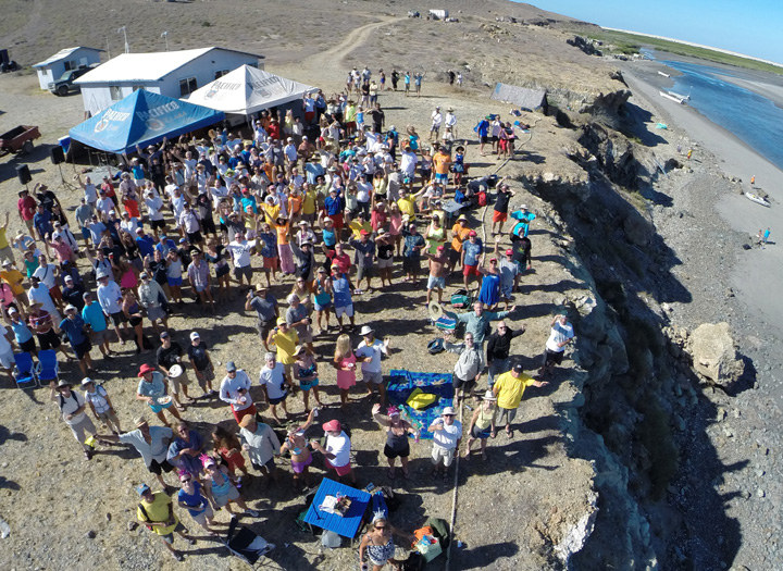
Bahia Santa Maria, of course, is the site of the Ha-Ha Rock ‘n’ Roll Party on the bluff. A live band comes all the way from La Paz to rock you, no matter if you want to dance or play volleyball or frolic in the surf down below. There is only one word to describe the Bahia Santa Maria experience — surreal. The bay is all but uninhabited 363.5 days of the year, and for 1.5 it’s full of Ha-Ha boats and 500 sailors.
©2015Latitude 38 Media, LLC
If you somehow managed to lose all your clothes but your ‘banana sling’ underwear at Bahia Santa Maria, no worries, as the 175-mile third leg to Cabo is guaranteed to be warm. Even in the middle of the night. We’ve sailed all over the world, and some of the last legs of the Ha-Ha have been among the most enjoyable sails we’ve ever had.
Once at Cabo there is the Squid Roe Ha-Ha Dance Fest, the Beach Party, the Here to Eternity Kissing Contest, the Awards Ceremony — and the sad goodbyes to lots of new friends. By the time the Ha-Ha is over in Cabo, you will have lived so intensely that it will seem that you left San Diego three months before.
On the fence about whether to do the Ha-Ha? We suggest you don’t listen to either us, as we’re biased, or the naysayers who have never done one. Put your trust in the advice of sailors who have actually done the Ha-Ha.
Just so everyone is clear, the priorities of the Ha-Ha are safety and responsible fun. As such, if you are looking to party! party! party! as if there is no tomorrow, or have issues with alcohol, neither the Ta-Ta or Ha-Ha is for you.
International Canal Update
©2015Latitude 38 Media, LLC
There are dozens of sailors listed on Latitude 38‘s West Coast Circumnavigator’s List, but we’d guess that this prestigious roster would shrink by more than half if those cruisers hadn’t had the option of transiting the Panama and Suez Canals, rather than going around Cape Horn and the Cape of Good Hope.
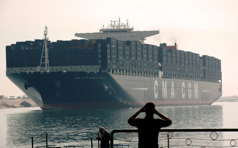
It’s too soon to tell how this month’s opening of a new Suez Canal and the soon-to-be-completed new ‘lane’ of the Panama Canal will affect sailors, but the optimist inside us is hopeful that transits for private vessels may be easier than ever. Time will tell.
©2015Latitude 38 Media, LLC
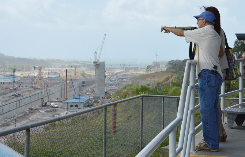
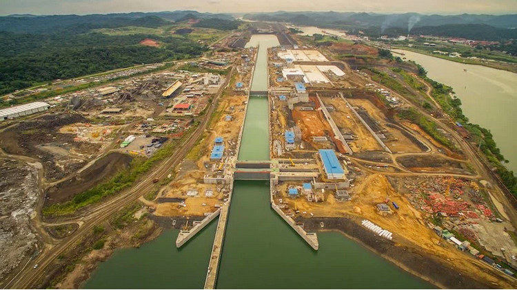
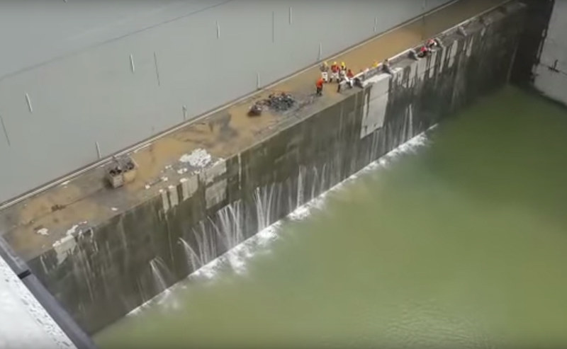
Cutting a new ditch through the Egyptian desert was relatively easy — it took only a year — compared to constructing a third set of locks alongside the existing Panama Canal. The tiny Central American country’s $5 billion project, which has suffered work stoppages due to underfunding and a related legal battle, was on a fast track to completion in early 2016. But last Friday a substantial horizontal leak was discovered in the "sill" beneath one of the massive rolling lock gates on the Caribbean side, necessitating a complicated and expensive repair. So the opening date for the new locks may be pushed back again. (They were originally slated to open this summer, 100 years after the original canal was completed.)
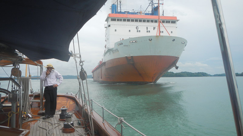
The new lane will be able to accommodate so-called New Panamax ships up to 1,200 feet long that can carry 13,000 containers (TEUs), as compared to the current 5,000-container capacity of existing Panamax ships, which have a max length of 965 feet.
According to the construction firm Salini Impregilo, a key partner in the massive project, it required the excavation of 50 million metric cubes of dirt and rock, the pouring of 5 million metric cubes of concrete (that’s 5 trillion liters!), and required the labor of more than 10,000 workers.
Meanwhile, 300 miles to the north in Nicaragua, a countrywide debate continues as to whether plans for a competing canal will ever take shape. Backed primarily by Chinese businessman Wang Jing, the $50 billion project was announced late last year, with a hopeful completion date of 2020. Spanning 170 miles — more than three times the length of the Panama Canal — the Nicaraguan canal would be the country’s largest infrastructure project ever.
According to a recent report by Bloomberg Business, excavation on the Pacific Coast is stated to begin this year, pending approval of an environmental impact report. Although this poor Central American country desperately needs economic stimulus, environmentalists as well as many citizens fear the ramifications of running international cargo ships through Lake Nicaragua, which is the country’s primary source of drinking water. Meanwhile, Jing’s Hong Kong-based HKND Group is reportedly looking for investors.
©2015Latitude 38 Media, LLC
