
October 28, 2003
Photos of the DayOctober 28 – San Diego Jeannine of Yachtfinders/Windseakers in 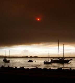 Boats moored off Harbor Island |
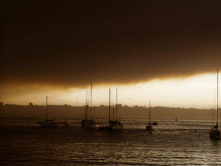 The mooring ground off Shelter Island 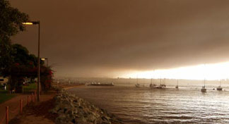 Streetlights remained on in broad daylight. Photos Martin Fogel |
The View from AboveOctober 28 – Southern California/Northern 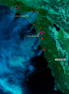 Sunday, around 1pm, about the time the Baja Ha-Ha West Marine Kick-Off Party started. Satellite Images Courtesy NOAA These satellite images come from the NOAA See www.noaanews.noaa.gov/stories2003/s2107.htm |
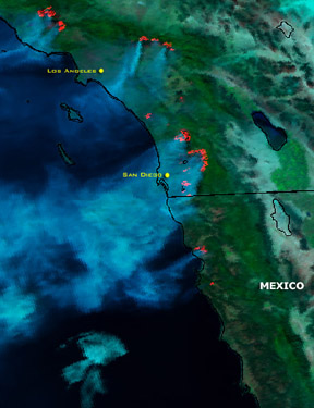 Monday, at 12:44 PST. The Baja Ha-Ha fleet would have been in the vicinity of the Mexican border, and would need to get past the fire near Ensenada to get fresh air. 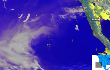 Monday, around ten in the morning. Winds out of the east-northeast have been blowing the smoke well out into the Pacific. |
YOTREPSOctober 28 – The Pacific Ocean and Cyberspace Who is out making passages in the Pacific |
Weather UpdatesOctober 28 – Pacific San Francisco Bay WeatherCheck out this guide to San Francisco Bay To see what the winds are like on the Bay The National Weather Service site for San California Coast WeatherLooking for current as well as recent wind Pacific Winds and PressureThe University of Hawaii Dept. of Meteorology Pacific Sea StateThe site for the Pacific Ocean sea states |
Top
/ Index of Stories /
Previous 'Lectronic Edition
Subscriptions
/ Classifieds
/ Home
38 Publishing Co., Inc.