
Who Ya Gonna Call?
We’ve got to hand it to the US Coast Guard. At the same time that Washington politicians are showing the maturity of a pack of third-graders by threatening to let funding for Homeland Security agencies lapse unless Obama’s recent immigration reforms are reversed, the dedicated personnel of the Coast Guard continue to put their lives in danger to rescue mariners in peril. No work stoppage. No slowdown. No whining.
As reported earlier, on Sunday a CG helicopter crew flew 150 miles offshore of Nantucket, MA into 60-mph winds to air-evacuate Jason McGlashan, 37, and his father Reg McGlashan, 66, from their 43-ft sloop Sedona. Rather than passing judgment on the idiocy of trying to sail south — and ultimately on to Australia — aboard a recently purchased, $10,000 eBay special when extreme weather was predicted, the Coasties arrived on the scene, lowered a rescue swimmer into the 43-degree water, and completed the rescue — despite the challenge of doing so in 25-ft breaking waves.
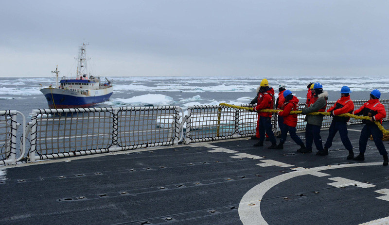
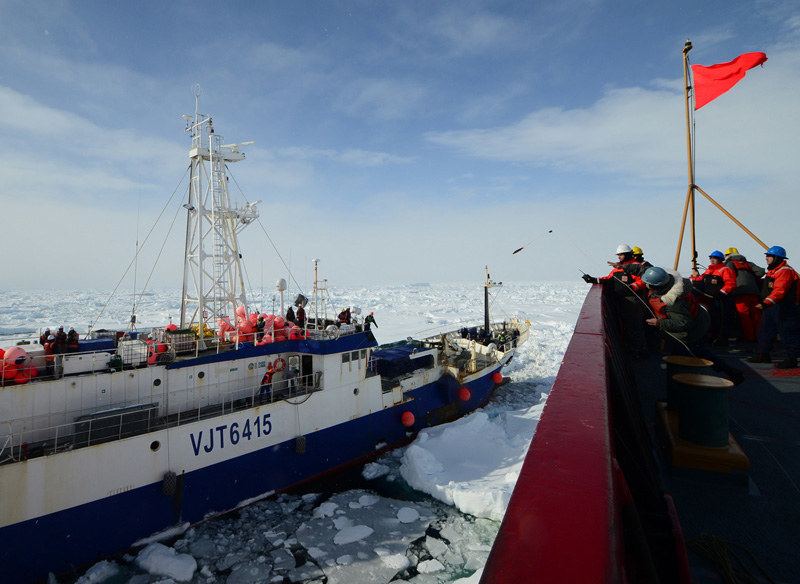
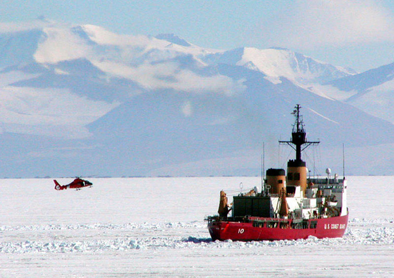
Meanwhile, on the same day an even more ambitious CG rescue operation was playing out 7,000 miles away in the Southern Ocean. The 207-ft Australian-flagged fishing vessel Antarctic Chieftain had been trapped in thick sea ice for nearly two weeks, roughly 900 miles northeast of Antarctica’s McMurdo Sound, when the Coast Guard Cutter Polar Star arrived to rescue the 26 stranded fishermen aboard and tow their vessel to safety. This was no small feat, as, according to a CG report, Polar Star had to "break through 150 miles of thick Antarctic ice and navigate around icebergs that were miles wide" in order to reach the Chieftain, which had broken three of its four props in the ice.
The 150-person crew "navigated through difficult weather conditions during the five-day rescue operation," reported a CG spokesman, "including heavy snow fall, high winds and extreme ice conditions. Coast Guardsmen aboard the Polar Star reported whiteout snow conditions early in the operation, and they were required to break through ice that had built up over several years, making it extremely thick."
If the Seattle-based cutter had not been temporarily deployed to McMurdo Station at the time, it is unclear if the stranded fishermen would have had an alternate means of escape. At 399 feet in length, the Polar Star is one of the Coast Guard’s largest ships, and one of the world’s most powerful non-nuclear icebreakers.
When you venture offshore it’s a great comfort to know the selfless personnel of the USCG have your back. To defund them for even five minutes would be the height of irresponsibility.
Are the New Charts Worse?
It’s not unheard of for new software to be less well liked than earlier versions of the same software. We find this to be the case with Navionics, the very popular marine charting software. In fact, we find the new Navionics software for the west coast of Mexico and the Eastern Caribbean to be so annoying that we’ve kept our old iPad with the old Navionics software because we find that combination so much more user friendly.
What drives us nuts with the new software? First of all, when trying to find distance from one place to another, you’re supposed to tap the screen to set up the first point. But unless you tap it the exactly the right way — and apparently we tap it the wrong way 90% of the time — a big message box that we don’t want to see comes up and dominates the screen. Thanks for nothing. With the old software, figuring out distances was trouble-free and took about two seconds.
The second thing we find irritating about the new Navionics software is that it can be difficult to determine the distance between two places in an area that you’re not in currently. For example, if you’re in San Francisco, and for trip planning purposes you want to know how far it is between Puerto Vallarta and Manzanillo, you have to manipulate the onscreen chart to the P.V. / Manzanillo area. Then you tap the screen to get the first of two ‘distance’ dots. Of course the taps don’t work, and after about 15 seconds, the chart automatically reverts back to the San Francisco area — whether you like it or not.
It’s entirely possible that we’re doing something wrong, but the old software was intuitive and easy. That’s not the case with the new Navionics software.
Furthermore, unless you hold your iPad or device level, the arrow showing what direction you’re going gets all out of whack. Since we’re often monitoring the speed and direction of our boat while lying in our bunk, the direction arrow is worthless — and once again, both frustrating and annoying. We didn’t have this problem with the old software.
It’s true that the new Navionics software has about 100 times more bells and whistles. We, unfortunately, are simple souls who just want to be able to get the basic information easily. And we’re finding we can’t do that easily with the new Navionics. Maybe we’re old and grouchy, but Navionics can keep all their bells and whistles.
Are we just ignorant, or are you having similar problems?