
November 14, 2003
Photo of the DayNovember 14 – Ventura Today’s Photo of the Day is one of good 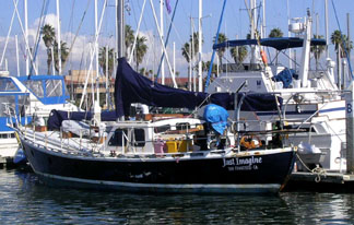 Photo Rick Hildahl If you’ve read the November issue of Latitude 38, you “On November 6, we were notified by The photo was taken last weekend by Rick |
One Third of Bison Removed from CatalinaNovember 14 – Santa Catalina Island One hundred of Catalina’s 300 bison have We’re not sure we approve. After all, what |
The Smoke Got in Our Eyes – and Everywhere
|
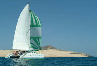
Looking Good!November 14 – Baja California 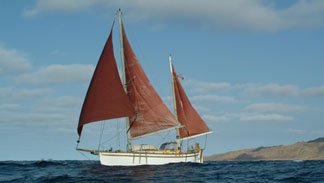 Photo Latitude How do you like this shot of Marek Nowicki’s |
Profligate’s
|
YOTREPSNovember 14 – The Pacific Ocean and Cyberspace Who is out making passages in the Pacific |
Weather LinksNovember 14 – Pacific San Francisco Bay WeatherCheck out this guide to San Francisco Bay To see what the winds are like on the Bay The National Weather Service site for San California Coast WeatherLooking for current as well as recent wind Pacific Winds and PressureThe University of Hawaii Dept. of Meteorology Pacific Sea StateThe site for the Pacific Ocean sea states |
Top
/ Index of Stories /
Previous 'Lectronic Edition
Subscriptions
/ Classifieds
/ Home
38 Publishing Co., Inc.