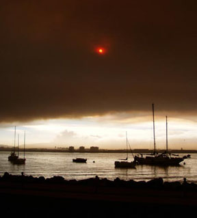
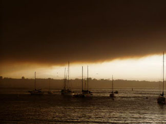
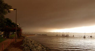
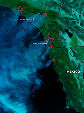
'Lectronic Index

Previous 'Lectronic Edition


Photos of the Day

October 28 - San Diego

Jeannine of Yachtfinders/Windseakers in San Diego sent us these photos of the view from their marina on Shelter Island and from Harbor Island. Taken on Sunday morning, they show clearly - well, clear is probably the wrong word.


Boats moored off Harbor Island


The mooring ground off Shelter Island


Streetlights remained on in broad daylight.

Photos Martin Fogel


The View from Above

October 28 - Southern California/Northern Baja


Sunday, around 1pm, about the time the Baja Ha-Ha West Marine Kick-Off Party started.
Satellite Images Courtesy NOAA

These satellite images come from the NOAA Significant Imagery Web site. More can be seen at www.osei.noaa.gov/Events/Fires.

See www.noaanews.noaa.gov/stories2003/s2107.htm for NOAA's current report. Pictures from this morning were not yet available when we posted. Winds are calm this morning.


Monday, at 12:44 PST. The Baja Ha-Ha fleet would have been in the vicinity of the Mexican border, and would need to get past the fire near Ensenada to get fresh air.


Monday, around ten in the morning. Winds out of the east-northeast have been blowing the smoke well out into the Pacific.


YOTREPS

October 28 - The Pacific Ocean and Cyberspace

Who is out making passages in the Pacific and what kind of weather are they having? The YOTREPS daily yacht tracking page has moved to www.bitwrangler.com/psn.


Weather Updates

October 28 - Pacific Ocean

San Francisco Bay Weather

Check out this guide to San Francisco Bay Navigational Aids: http://sfports.wr.usgs.gov/sfports.html.

To see what the winds are like on the Bay and just outside the Gate right now, check out http://sfports.wr.usgs.gov/wind.

The National Weather Service site for San Francisco Bay is at www.wrh.noaa.gov/Monterey.

California Coast Weather

Looking for current as well as recent wind and sea readings from 17 buoys and stations between Pt. Arena and the Mexican border? Here's the place - which has further links to weather buoys and stations all over the U.S.: www.ndbc.noaa.gov/Maps/Southwest.shtml.

Pacific Winds and Pressure

The University of Hawaii Dept. of Meteorology page posts a daily map of the NE Pacific Ocean barometric pressure and winds.

Pacific Sea State

The site for the Pacific Ocean sea states has moved to http://www.mpc.ncep.noaa.gov/shtml/PacRegSSA.shtml.
For views of sea states anywhere in the world, see http://www.oceanweather.com/data.


Top / Index of Stories / Previous 'Lectronic Edition

Subscriptions / Classifieds / Home

©2003 Latitude 38 Publishing Co., Inc.