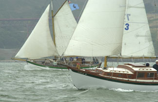
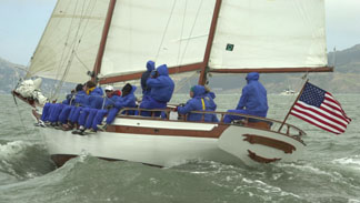
Photos of the Day

May 23 - Miraflores Locks, Panama

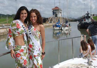
"'Where Do I Find Crew Like Carla?' was asked in a previous edition of 'Lectronic Latitude," notes Greg Retkowski of the Morgan Out-Island 41 Scirocco. "A good place to look recently would have been the Miraflores Locks, which are part of the Panama Canal. The Miss Universe contestants did a photo shoot while transiting the Canal on May 21 in preparation for the competition on June 3. Unconfirmed sources say the contestants are available for line-handling for those yachts making the transit in the coming weeks!"


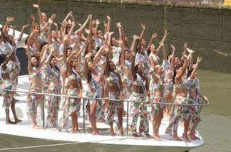
Photos Courtesy Greg Retkowski


It's Memorial Day Weekend!

May 23 - San Francisco Bay

Some people think it's the unofficial start of summer, but it's really the Master Mariners Race weekend. They'll be reaching back and forth across the Central Bay most of Saturday afternoon, with the best action likely to be behind Treasure Island. It's supposed to be windy, so it should be a good show. Here's what they looked like last year.

Photos Latitude/JR


Great American II on Record Pace

May 23 - Atlantic Ocean

We've been remiss in not keeping up with this, but Rich Wilson and Rich de Moulin, both of the Northeast, are about 1,000 miles from the finish of their Hong Kong to New York passage, having been underway for 66 days. Sailing their 53-ft trimaran Great American II, their goal is to beat the extreme clipper Sea Witch's time of 74 days. Currently, the duo are about 140 miles ahead of the clipper ship's pace.


YOTREPS

May 23 - The Pacific Ocean and Cyberspace

Who is out making passages in the Pacific and what kind of weather are they having? The YOTREPS daily yacht tracking page has moved to www.bitwrangler.com/psn.


Weather Updates

May 23 - Pacific Ocean

San Francisco Bay Weather

To see what the winds are like on the Bay and just outside the Gate right now, check out http://sfports.wr.usgs.gov/wind.

The National Weather Service site for San Francisco Bay is at www.wrh.noaa.gov/Monterey.

California Coast Weather

Looking for current as well as recent wind and sea readings from 17 buoys and stations between Pt. Arena and the Mexican border? Here's the place - which has further links to weather buoys and stations all over the U.S.: www.ndbc.noaa.gov/Maps/Southwest.shtml.

Pacific Winds and Pressure

The University of Hawaii Dept. of Meteorology page posts a daily map of the NE Pacific Ocean barometric pressure and winds.

Pacific Sea State

Check out the Pacific Ocean sea states at: http://www.mpc.ncep.noaa.gov/RSSA/PacRegSSA.html.
For views of sea states anywhere in the world, see http://www.oceanweather.com/data.


Top / Index of Stories / Subscriptions / Classifieds / Home

©2003 Latitude 38 Publishing Co., Inc.