
| |
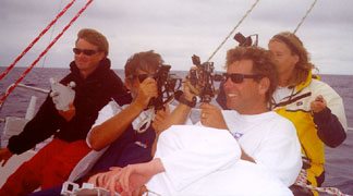
August 24 - Pacific Ocean
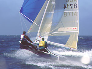
A strange thing happened to the Santa Cruz 52 'Vitesse' on
her delivery home from Hawaii: Her entire five-person crew, lead
by Robert Flowerman of Sausalito, decided they want to do some
celestial navigation. For those of you who've grown up in the
era of $99 GPS units, celestial was one of the main navigation
tools available to mariners, and required shooting celestial bodies
with a sextant and working out the math. So there they are, in
the photo at left: Howard, half of Harry (way down at the bottom),
Robert, Doug and Susan. Frankly, we suspect this was a staged
photograph, for the skies look overcast, and a sextant is about
as useful as a bicycle on a boat when it's cloudy.
 |
 |
August 24 - Atlantic/Caribbean
When hurricanes pass over land, they lose the warm moist air
that helps fuel them. So when Hurricane Debby passed over Hispañola,
she came out of it a mere tropical storm. Nonetheless, she's expected
to regain strength as she continues on toward Cuba and perhaps
the Florida Keys. Meanwhile, Alberto, which started way back on
August 4 is still kicking up 45-knot winds up near Greenland.
The tropical Eastern Pacific is quiet, but expect more storms
soon. For details on tropical activity, visit http://weather.unisys.com/hurricane/atlantic/2000/index.html
and http://weather.unisys.com/hurricane/e_pacific/2000/index.html
|
August 24 - Pacific Ocean San Francisco Bay WeatherTo see what the winds are like on the Bay right now, check out http://sfports.wr.usgs.gov/wind/. It's a great time of year to be sailing the Bay. California Coast WeatherLooking for current as well as recent wind and sea readings
from 17 buoys and stations between Pt. Arena and the Mexican
border? Here's the place - which has further links to weather
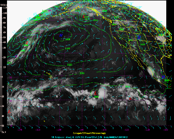
buoys and stations all over the U.S. Pacific Ocean WeatherCheck out the graphic at right. |
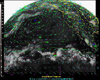 University of Hawaii Meteorology Graphic |
Seas are normal in the Pacific. But you might check at:
http://www.mpc.ncep.noaa.gov/RSSA/PacRegSSA.html.
For another view, see http://www.oceanweather.com/data/global.html.
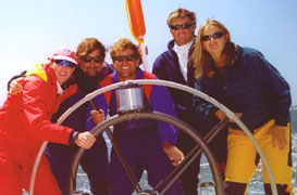
CruisingToo Much Weather Information?August 24 - The South Pacific When Bill and Sam Fleetwood of the Monterey-based Gulfstar
50 'Blue Banana' did the Puddle Jump earlier this year, they
knew they were going in season and thus didn't bother to consult
weather gurus or weatherfaxes before casting off. They had a
great trip. But now that they're getting more weather information
in the South Pacific, they're confused: "We don't know if
it's a weird weather year, we've turned chicken, or we've been
getting too much weather information, but ever since we started
downloading weather faxes and starting learning about highs,
lows, troughs and fronts, we can't seem to find a favorable departure
date for the next destination!" |
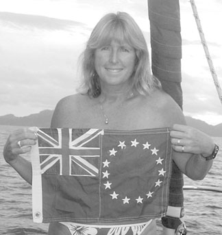 Sam Fleetwood displays the Cook Islands flag she sewed. Photo Courtesy the Fleetwoods |
August 24 - The Pacific Ocean and Cyberspace
Who is out making passages in the Pacific and what kind of weather are they having? Check out YOTREPS - 'yacht reports' - at http://www.bitwrangler.com/yotreps/
|
August 24 - San Francisco and Monterey Bays Photo Scott Lechner |
 |
Top / Index of Stories
/ Subscriptions
/ Classifieds
/ Home©2000 Latitude 38 Publishing
Co., Inc.