
Harming or Helping the Delta?
In July, the California Department of Water Resources sent out the following press release:
"The California Department of Water Resources (DWR) today released a Draft
Supplemental Environmental Impact Report/Environmental Impact Statement (EIR/EIS) for California WaterFix. The document analyzes several proposed changes designed to reduce the project’s footprint and costs, and minimize impacts on environmental resources in the Sacramento-San Joaquin Delta (Delta), including wetlands and other water resources.
"Public comment will be accepted through Sept. 17, 2018. DWR will respond to all substantive comments received on the Draft Supplemental EIR/EIS and consider them in the decision-making process.
"The proposed modifications analyzed in the environmental document released today have not changed the impact conclusions for any resource areas. The modifications include:
"Changing the locations of reusable tunnel material storage sites near the intermediate forebay, on Zacharias Island, on Bouldin Island, and near the relocated Byron Tract Forebay. Relocating the tunnel boring machine (TBM) launch shaft and barge landing location on Bouldin Island. Creating a new Byron Tract Forebay (eliminating the extensive modifications to Clifton Court Forebay) and relocating the consolidated pumping plant. Realigning the 40-foot diameter tunnels slightly to accommodate the relocated Bouldin Island TBM launch shaft and Byron Tract Forebay consolidated pumping plant relocation. Relocating or eliminating appurtenant facilities such as barge landing sites, concrete batch plants, and construction access roads to improve facility design. Realigning the 40-foot diameter tunnels to avoid the town of Hood and municipal water wells.
"DWR released the Draft Supplemental EIR/EIS as the lead state agency in compliance with the requirements of the California Environmental Quality Act. As the federal lead agency, the U.S. Bureau of Reclamation will release the Draft Supplemental EIR/EIS separately for public review in compliance with the National Environmental Policy Act.
"To access the public review draft and associated environmental documents, please visit:
https://californiawaterfix.com/resources/draft-supplemental-environmental-impact-report-environmental-impact-statement-eir-eis."
© Latitude 38 Media, LLC
Bill Wells, executive director of the Delta Chambers of Commerce & Visitors Bureau, just about flipped his lid when he read this. (Bill also writes the Delta Rat column for Bay & Delta Yachtsman and has been a supporter of Latitude 38’s Delta Doo Dah cruising rally for many years.) "This is more like a state plan to further damage Delta businesses," he wrote. "These people have no idea what they are doing. Their plan for Bouldin Island (owned by Metropolitan Water District) will destroy Tower Park Resort by dumping thousands of tons of chemical-laced mud on the island just across Little Potato Slough from Tower Park and its outdoor restaurant. The stench when it is wet will be unbearable, and when it dries the dust sent by the prevailing wind will cover the resort."
© Latitude 38 Media, LLC
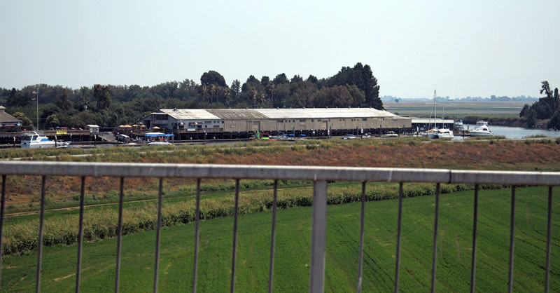
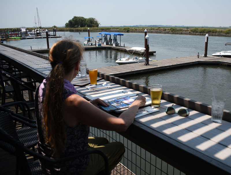
Tower Park is a valuable resource to locals and visitors, by land and water, not to mention all the people it employs. "I was outraged when I heard this," adds Bill. "The owners have just put millions into Tower Park. They even have outdoor seating in the restaurant facing toward Bouldin Island." Bouldin Island is currently planted with corn and alfalfa. Hwy. 12, the east-west artery of the Delta, runs through it. The South Fork of the Mokelumne River borders its north shore, and Potato Slough, which is very popular with sailors, runs along its south shore.
© Latitude 38 Media, LLC
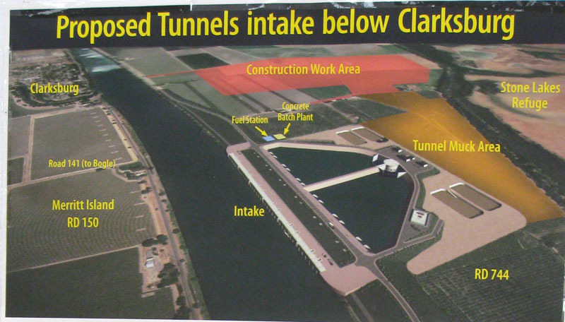
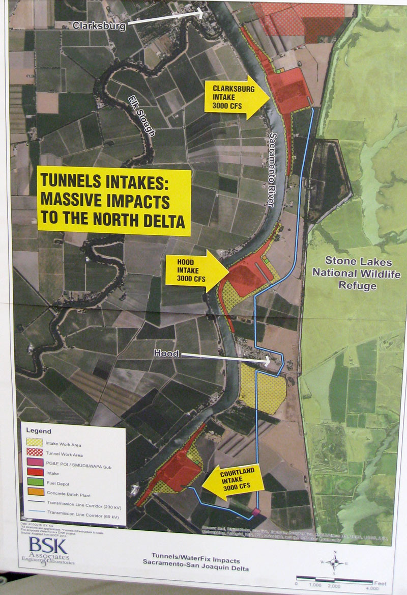
The folks from North Delta CARES had a display at the recent Courtland Pear Fair. According to the graphics, Courtland and Hood, on the east side of the Sacramento River, are ground zero for Tunnels intake construction, and Clarksburg, on the west side, faces another intake construction site. These are all charming but small communities worth defending.
We invite substantive comments from both sides of this controversy.