Photos of the Day

October 17 - Mystery Location

Who can identify this mystery harbor? Hints: Most people come by tour bus rather than boat. There's a tidal range of 9 feet. The Baltic 39 we were aboard was the biggest sailboat in the harbor. Even though it was early October, there were still too many tourists. Nonetheless, it was a friendly place - they didn't even charge us for the mooring. Send your answers to Richard.


Photos Latitude/Rob


Cruising in Muslim Countries

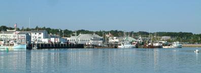
October 17 - Port Dickson, Malaysia

"I'm currently at Admiral Marina in Port Dickson, Malaysia," reports John Keen of the San Francisco-based Gulf 32 Pilothouse Knot Yet. "The trip up from Singapore was not pleasant, as I had both wind and seas on the nose. It's been five months since I've sailed/motored into the wind, and I'd forgotten how unpleasant it can be. Further hindered by strong currents, for several hours I was only doing a knot or two over the bottom.

"Enough whining! As to your question about whether I feel safe cruising in Muslim
countries, I'm glad that I have left Indonesia - though I didn't sense any hostility in the areas which I visited. Naturally, I avoided the hot spots. Malaysia, where I am now, also has a large Muslim population, but again they seem to be rather relaxed people. Immigration, Customs and the Port Captain, for example, were very friendly today. I intend to visit Melaka (Malacca) and Kuala Lumpur in the next few days, and will advise further. For better or worse, the government is pretty strict about dissent, and they do value the dwindling tourist industry.

"Topic A among cruisers, as you might expect, is whether the Red Sea will be safe next year. Views range from 'I'm going via South Africa,' to 'I'm going to wait a year,' to 'there'll be so many U.S. Navy ships in the Red Sea that we'll be safe,' to 'I want to ship the boat home.' I'm in the 'wait and see' camp, and expect that I will continue in that direction in January."


Sunday's Photos Were Taken Saturday

October 17 - San Francisco Bay

Several observant folks caught an error in yesterday's 'Lectronic Latitude. Specifically, a number of photos we claimed were taken last Sunday were actually taken last Saturday. Our apologies. To make up for it, here's some more shots that were taken last weekend.

Photos Latitude/Richard


YOTREPS

October 17 - The Pacific Ocean and Cyberspace

Who is out making passages in the Pacific and what kind of weather are they having? Check out YOTREPS - 'yacht reports' - at http://www.bitwrangler.com/yotreps/


Weather Updates

October 17 - Pacific Ocean

San Francisco Bay Weather

To see what the winds are like on the Bay and just outside the Gate right now, check out http://sfports.wr.usgs.gov/wind/. (Note: Service on this site has been interrupted, and they hope to have it repaired soon. We'll keep an eye on it and let you know.)

California Coast Weather

Looking for current as well as recent wind and sea readings from 17 buoys and stations between Pt. Arena and the Mexican border? Here's the place - which has further links to weather buoys and stations all over the U.S.: www.ndbc.noaa.gov/stuff/southwest/swstmap.shtml.

Pacific Winds and Pressure

The University of Hawaii Dept. of Meteorology page posts a daily map of the NE Pacific Ocean barometric pressure and winds.

Pacific Sea State

Check out the Pacific Ocean sea states at: http://www.mpc.ncep.noaa.gov/RSSA/PacRegSSA.html.
For another view, see http://www.oceanweather.com/data/global.html.


Top / Index of Stories / Subscriptions / Classifieds / Home

©2001 Latitude 38 Publishing Co., Inc.